Earlier this year we walked The Winterbourne Walk from the Ver Valley Society. It heads out from Redbourn towards Flamsted and comes back past the Herts Showground and follows part of the Chiltern Way. It’s quite a long walk – about 8 miles – and took about 4 hours. The start and end section of the walk are shared with Ver Valley Walk 4 the Redbournbury Walk.
As you set off on the walk, the early section takes you through the streets of Redbourn and the Churchyard of St Mary’s Church. The houses here are really pretty and homely and the Church itself is very delightful and welcoming.

Church End 
St Mary’s Church
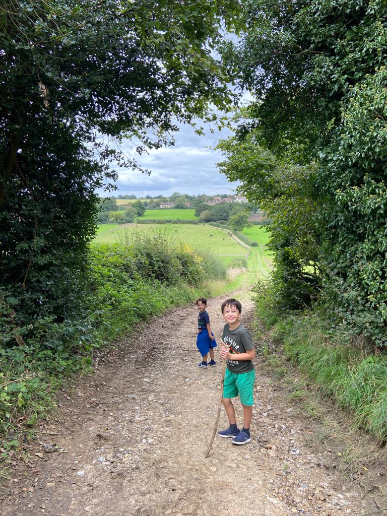
One of the parts I most remember of the walk is as you approach Flamsted. You’ve been walking along the edge of fairly flat fields, nondescript as a few had already been harvested and were just turned mud. As you reach the end of one of the fields there’s an opening waiting to guide you on and you are presented with this view. It’s like the trees are surrounding the picture like a painting of the countryside around Flamsted with Flamsted in the centre. At this distance, it all looks unspoilt, like it might have done 200 years ago.

When you get back into Redbourn you can pass a Ford in the River which is great to paddle in after the long walk.
This was my favourite part of the walk. This is a long walk and everyone’s legs and feet were a bit tired by the time we got back to Redbourn. The cool of the spring water in the ford was really welcome. The track through the stream had been covered by a build-up of algae that made it really slippy to first Euan then Fergus fell in so be careful. Fergus decided he really liked the cool water and just sat down and enjoyed it.
This is a good long walk for an afternoon. It doesn’t feel like it packs in as many sights as some of the other Ver Valley walks, it’s not really that sort of walk, it’s much more about getting out and really stretching your legs in the country.
The Ver Valley Society Leaflet that supports the walk can be found here.
Route map, directions and GPS for the route can be found on my plotaroute page:
And here’s a link to the walk mapped on AllTrails: