Recently, we decided to go on a walk with our friends. We chose this walk from the Ver Valley Society. It’s perfect for a warm day because there’s lots of shade and a few bits where you can go for a paddle.

To make the walk more interesting my dad did some research around chalk streams, finding out why they’re important, so he could talk to us about them as we walked. Chalk Streams are streams that flow through chalk hills towards the sea. Chalk is porous and so acts as a natural filter, meaning that the water in chalk steams is very clear. As chalk is alkali, the water that flows through is alkaline. As rainwater is slightly acidic, alkaline streams are quite unusual and attract different sorts of plants and wildlife to other streams. There are only about 200 that exist in the world and about 85% are in the UK.
As the chalk is porous that means a lot of water seeps into the rock, collecting beneath the surface in big caves called aquifers. Water companies have been taking water from these aquifers to help with the water supply and because Britain is using ever more water per person, the aquifers have been drained and many of the rivers are now endangered, dun dun duuuuun!
The World Wild Fund is trying to help preserve chalk streams, here’s a video they made to help explain their campaign.
We started our walk at the Cricket Clubhouse on Redbourn Common, where we met up with our friends.

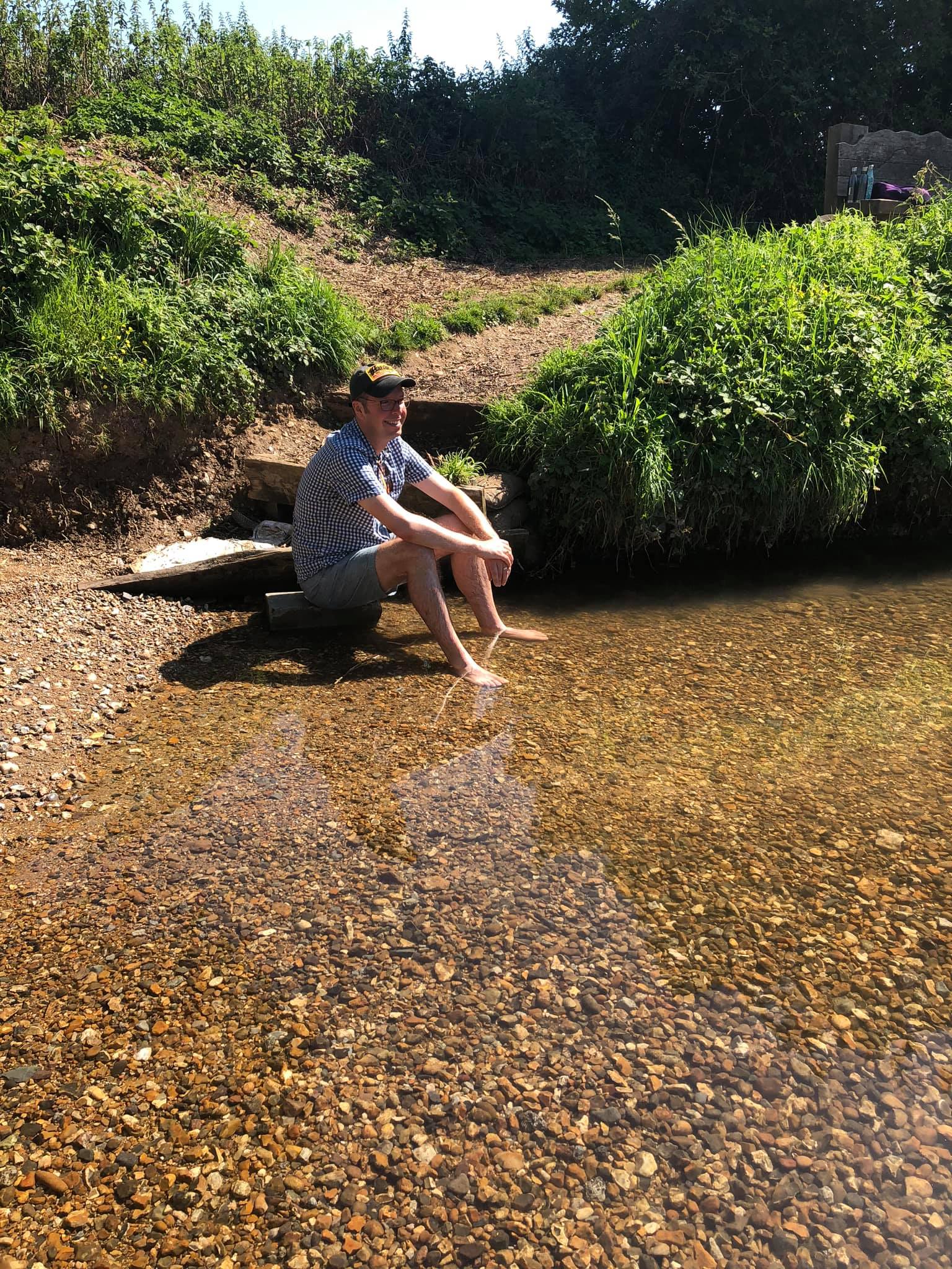
Almost as soon as you leave Redbourn Common you come across a chalk stream. Daddy told us this was the River Red which is a tributory (which means a smaller river that runs in to a bigger river), to the River Ver.

Having walked along a country lane and across a main road we were quickly outside Redbourn in to open fields. The first field was full of these black looking plants. When you opened the pods they looked like green beans but they seemed to have been allowed to grow too long and the hot sun had turned them black. You wondered if the farmer had made a mistake or been unwell and not been able to harvest them.

We went on to a wheat field. There was a large hill that was surprisingly harder to go up than we first anticipated. We went through a gate onto a road where we took a quick rest, it was really quiet and while we were walking on it we didn’t see a single car.
On the road there were two remote cottages. The first one was really old and called The White Cottage. The one beside it was called The New Cottage. It seemed funny that it was called ‘New’ as it looked like it had been there at least 30 years, but it was definitely new compared to The White Cottage.


The New Cottage
When you fork left at New Cottage you end up on some quiet country lanes rather than walking through fields. It’s funny that these little lanes are well kept, they have markers and signs on them, and stiles for people to pass across, but it seems like there’s only a few people using them.


After walking through some lanes and fields, passing a couple of quite big houses, and heading down a long quiet road called Punch Bowl Lane, we were led across a narrow pathway through a corn field taking us back towards the River.

When you reached the River it was quite wide at this point and so we had to cross using stepping stones. We nearly slipped because the second stone was so slippery.
Our friend’s dad, Matt (with 2 t’s), took a video of us crossing the stones. He was hoping to capture someone falling in but was let down when nobody did (I think he was joking :)).
We were getting ever nearer to the main paddling pool but we had to go through a field of cows to get there. They were all pretty calm but it was a little nerve-wracking watching them as a couple had dangerous looking horns…
Back to some of the characteristics of chalk streams. Because of the amount of water stored in these large underground caves the water keeps a pretty constant temperate of about 10 degrees all year round. That actually means that on a cold winter day, where the air temperature is colder than the water temperature, water vapour can rise from the stream like fog or steam. On a hot summer day, it means the water is still cool and refreshing. When you first get in, to start off with it feels very cold, but eventually, you get used to it and it starts to feel a little warmer. After a while, you start to appreciate how nice it is to have a refreshing paddle on a hot day.


The last section of the walk brings you through more fields, next to woods, and by the side of Harpenden Golf Course, before taking you back to Redbourn where you finish the walk. It’s the second time we have come across the golf course, it’s very nice and well kept.

Fergus wanted to get a picture of himself, approaching the end of the walk just by the golf course. The area is a bit wild and overgrown so Fergus pretended he was a wild animal coming to get his prey.

There are some nice houses when you’re going through the streets of Redbourn on the way back, they’re obviously very old but have been kept in very good condition.


It’s a very good walk. You can see all the scenery around Redbourn and get some exercise. It feels like I’m much more likely to remember doing this, in years to come, than a morning watching TV or playing computer games.
Here’s the directions on PlotaRoute. If you click on the Plotaroute.com link in the bottom corner, or the Menu option that appears when you click Play, you can see all sorts of options for downloading the maps to different navigation apps (i.e. Google / Apple Maps) and see additional details on the route, such as photos along the way.
We’ve also recorded the route on AllTrails. You can find the link below. What we’ve found is that PlotaRoute has the most options of all the sites – letting you add the most comments and details to a route – and it is best for drawing a route on a map (rather than recording it). However, it doesn’t offer you a Recording option, so if you are going out to walk a route and can record it you have to use another site to do that. AllTrails lets you record a route, attach photos on the journey so they automatically appear at the right location, and then you can download the GPS file. So we’re using AllTrails to record the routes and then using the GPS download to help create the PlotaRoute directions.
Looks absolutely stunning I definitely would like to do this walk when I’m next over visiting.